

- Price
- From 40,000
- Currency
- £
- City
- Leek, Rudyard
- District / postcode
- Reacliffe Road, Staffordshire Moorlands
- Property type
- Development land
- Stage
- Land without planning
- Planning permission
- None
- Area, m²
- 6954
- Number of units
- 3
- Tenure
- Freehold
- Source (TALO.pro)
- https://talo.pro/project/project_1890/
Three freehold woodland plots off Reacliffe Road in Rudyard near Leek (Staffordshire Moorlands), on raised ground above Rudyard Reservoir. Price per TALO.pro: from £40,000 per plot.
What is for sale
Location
Leek is about 4 miles away and Macclesfield 13 miles. Rudyard Reservoir is over 2.5 miles long and covers 168 acres; the listing says it draws more than 500,000 visitors a year for sailing, fishing, canoeing, paddle boarding and a circular walk that runs along Reacliffe Road. Neighbouring landowners have already built campsites and lakeside lodges, so the listing pitches tourism uses such as glamping or eco-lodges. It is a very different product from urban land like the plot by the station in Great Sankey, but the logic is the same as the land off Sowgate Lane in Pontefract: a cheap entry with no consent and a bet on future planning.
Engineering view
The key point is that the land has no services at all, so any tourism scheme has to be designed off-grid. Water means a borehole or a main extended from the nearest network point (check whether this is United Utilities or Severn Trent territory). Power means either an expensive cable run through the woodland, or solar with batteries and a backup. Foul drainage means a package treatment plant, and discharging treated effluent right next to a reservoir will need an Environment Agency permit, which could be the deciding issue. Because of the TPO, every lodge needs an arboricultural survey to BS 5837 with root protection areas; in practice that means screw-pile foundations and minimal earthworks. The slope towards the water needs surface water control and a ground stability check. And Reacliffe Road is narrow and shared with a walking route, so plan the delivery of modular lodges and plant early.
Photos
Project details and ROI request: TALO.pro
This project in other languages: Русский · 中文
What is for sale
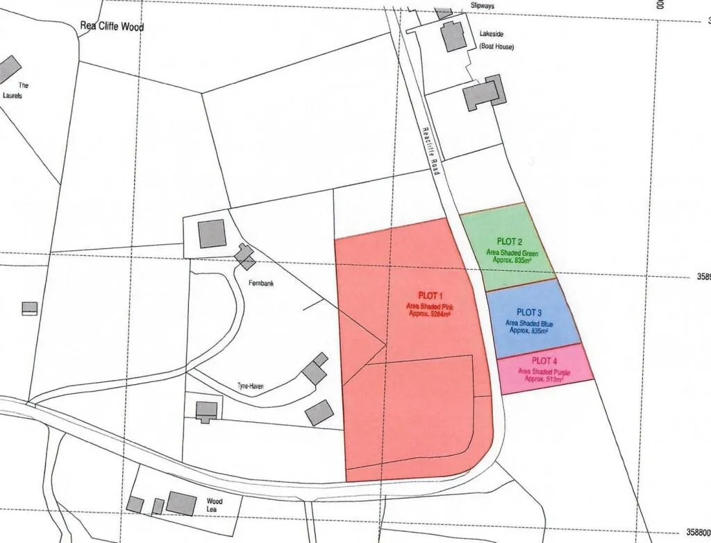
- Plot 1: 5,284 sq m, guide £60,000+; Plots 2 and 3: 835 sq m each, guide £40,000+; Plot 4 (513 sq m) is already sold
- Three plots run down to the reservoir shore, all with road frontage
- Mature mixed native woodland covered by a Tree Preservation Order (TPO)
- Freehold with vacant possession, no mains services connected
- Plot 1 carries a 35% overage for 25 years on any residential or commercial consent
- No planning in place; sold by private treaty, individually or together
Location
Leek is about 4 miles away and Macclesfield 13 miles. Rudyard Reservoir is over 2.5 miles long and covers 168 acres; the listing says it draws more than 500,000 visitors a year for sailing, fishing, canoeing, paddle boarding and a circular walk that runs along Reacliffe Road. Neighbouring landowners have already built campsites and lakeside lodges, so the listing pitches tourism uses such as glamping or eco-lodges. It is a very different product from urban land like the plot by the station in Great Sankey, but the logic is the same as the land off Sowgate Lane in Pontefract: a cheap entry with no consent and a bet on future planning.
Engineering view
The key point is that the land has no services at all, so any tourism scheme has to be designed off-grid. Water means a borehole or a main extended from the nearest network point (check whether this is United Utilities or Severn Trent territory). Power means either an expensive cable run through the woodland, or solar with batteries and a backup. Foul drainage means a package treatment plant, and discharging treated effluent right next to a reservoir will need an Environment Agency permit, which could be the deciding issue. Because of the TPO, every lodge needs an arboricultural survey to BS 5837 with root protection areas; in practice that means screw-pile foundations and minimal earthworks. The slope towards the water needs surface water control and a ground stability check. And Reacliffe Road is narrow and shared with a walking route, so plan the delivery of modular lodges and plant early.
Photos
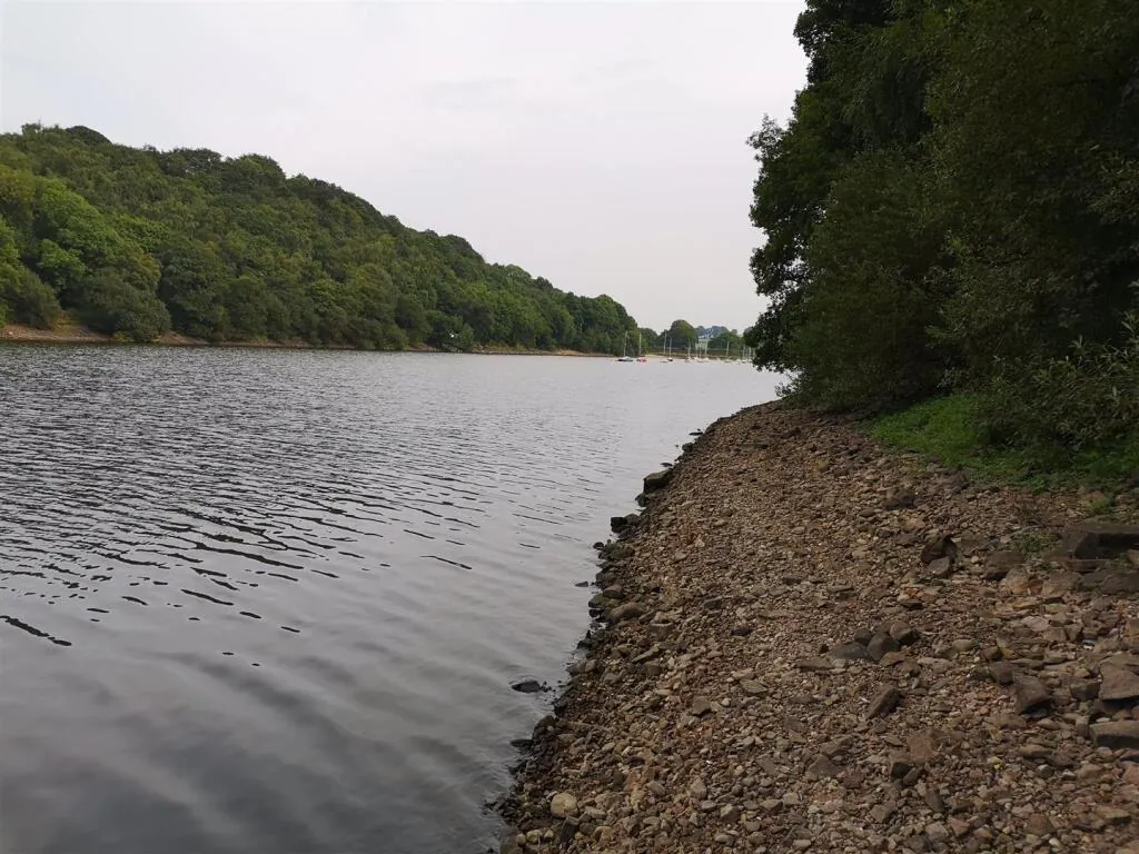
Rudyard Reservoir, Leek - shore next to the woodland plots
Rudyard Reservoir in the Staffordshire Moorlands near Leek: three of the freehold woodland plots...
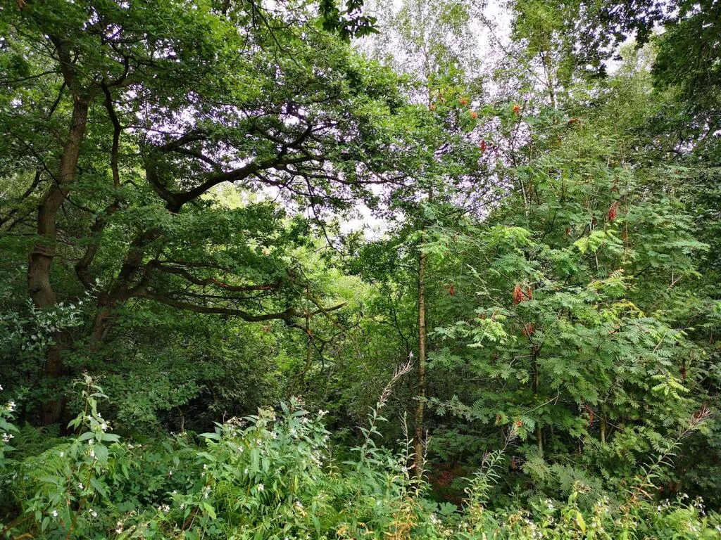
Reacliffe Road, Rudyard - mixed native woodland on the plots
Mature mixed native woodland on the plots off Reacliffe Road, Rudyard. The trees are covered by...
Rudyard woodland plots - site plan off Reacliffe Road, Leek
Site plan of the four woodland plots off Reacliffe Road, Rudyard, Leek: Plot 1 about 5,284 sq m...
Project details and ROI request: TALO.pro
This project in other languages: Русский · 中文